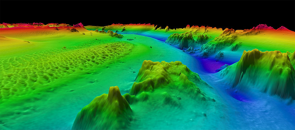
MULTIBEAM HYDROGRAPHIC SURVEY


FUNDING PARTNERS


Open Ocean Robotics’ uncrewed surface vehicle (USV) DataXplorer™ was deployed in a pilot project with the Canadian Coast Guard to demonstrate its ability to accurately, sustainably, and autonomously conduct multibeam hydrographic surveys. DataXplorer™ successfully surveyed underwater areas to international standards at up to 130 metre depths, operating for a total of 38 hours. The vessel was powered by a combination of solar and stored energy, showcasing its ability to provide a cost-effective and zero-emission solution for continuous hydrographic surveying. To learn more about how DataXplorer™ supports offshore energy operations, visit our Offshore Energy Market page.

The principal objective of this hydrographic survey was to acquire bathymetric data for the compilation of nautical charts with emphasis on the features that may affect safe navigation, using solar-powered emission-free assets, and increasing safety while surveying uncharted shallow waters.
MISSION

SOLUTION
We offer a safer, more efficient and affordable way of collecting data compared to conventional crewed vessels. Using solar or wind power, our boats produce no greenhouse gases, noise pollution or risk of oil spills.
DataXplorer™'s shallow draft and customizable sensor payload allow for high-quality near-shore coastal survey.

GOALS
HIGHLIGHTS
-
First ever multibeam hydrographic survey with a solar-powered uncrewed surface vehicle (USV)
-
Quality of the data was excellent and met all criteria to meet IHO standards.
-
The USV operated reliably, and demonstrated itelf to be an efficient tool for conducting multibeam surveys.
RESULTS
Endurance
Missions

Over the course of four days, DataXplorer™ conducted 38 hours of uncrewed hydrographic survey operations.
The longest non-stop survey session (moving at 2 knots) was 12 hours, with 53% battery capacity remaining, demonstrating the vessel’s ability to survey continuously for 20+ hours.


Remote Operations

An onshore remote operator could continually assess both navigational and survey data in real-time through Wi-Fi and cellular networks, allowing him to adjust acquisition settings and vessel control for optimal performance.
Open Ocean Robotics followed established best practices during calibration, acquisition, and data processing.


Quality Data Collection

Third party-analysis of the data and procedures confirmed that the data exceeded International Hydrographic Organization (IHO) Special Order Standards.


BENEFITS DEMONSTRATED
-
Safe & reliable tool for surveying shallow waters
-
Sustainable, emission-free surveys
-
Third-party analysis of the data and procedures confirmed that the data exceeded International Hydrographic Organization (IHO) Special Order Standards.
CLIENTS & PARTNERS


.png)